
Spring Valley ZIP Code Coverage
Spring Valley is a Clark County CDP and unincorporated town, not an incorporated city. Its working ZIP set is an address-verification set, not a city-limit list. County GIS supplies the ZIP-boundary and Spring Valley TAB layers, while USPS confirms delivery ZIPs at the address level. The table keeps the postal relationship visible without claiming that every address in a ZIP lies inside Spring Valley.
| ZIP | Relationship to Spring Valley | Post office | Record note |
|---|---|---|---|
| 89103 | Central and east Spring Valley with west-valley areas | USPS Las Vegas delivery area | Postal city can say Las Vegas |
| 89113 | Southwest area near Blue Diamond, Rainbow, and Durango | USPS Las Vegas delivery area | Verify the parcel at planning-area edges |
| 89117 | West and central area near Spring Mountain and Desert Breeze | USPS Las Vegas delivery area | TAB meeting ZIP does not prove town coverage |
| 89118 | South-central area near Russell and Valley View | USPS Las Vegas delivery area | ZIP crosses urban-valley geography |
| 89139 | Southwest valley toward Blue Diamond and Rhodes Ranch | USPS Las Vegas delivery area | Some addresses extend beyond the CDP or TAB boundary |
| 89146 | West-central valley and Spring Valley edge | USPS Las Vegas delivery area | Postal and town boundaries differ |
| 89147 | Central and west area near Flamingo, Durango, Jones, and Peace Way | USPS Las Vegas delivery area | County parcel samples use a Spring Valley label |
| 89148 | Southwest Spring Valley and newer subdivisions | USPS Las Vegas delivery area | County parcel samples use a Spring Valley label |
The official text review did not capture individual USPS station names for each ZIP. For that reason, the table uses the verified delivery-area description rather than inventing station assignments. A parcel can carry its ZIP, postal city, Spring Valley town label, tax district, and APN at the same time.
Verify a Spring Valley ZIP Code
Use the complete address first. The USPS ZIP Code Lookup is the address-level authority for delivery ZIP verification. Next, open Clark County’s ZIP-boundary Valley map and Spring Valley TAB map. Then inspect the Assessor parcel for its location city or unincorporated-town field and tax district. OpenWeb provides an additional jurisdiction label tied to the mapped parcel. Recording each result in separate columns prevents a loose neighborhood label from replacing a parcel check.
- Enter the full street address in the USPS address-to-ZIP tool and save the returned ZIP and postal city.
- Use the Clark County GIS maps to compare ZIP and Spring Valley boundary layers.
- Search the Assessor record by address or parcel number and record the location and tax fields.
- Open the parcel in OpenWeb, then keep the ZIP, postal city, town or CDP status, and APN as separate facts.
The USPS address lookup is the source for this Spring Valley ZIP code check.
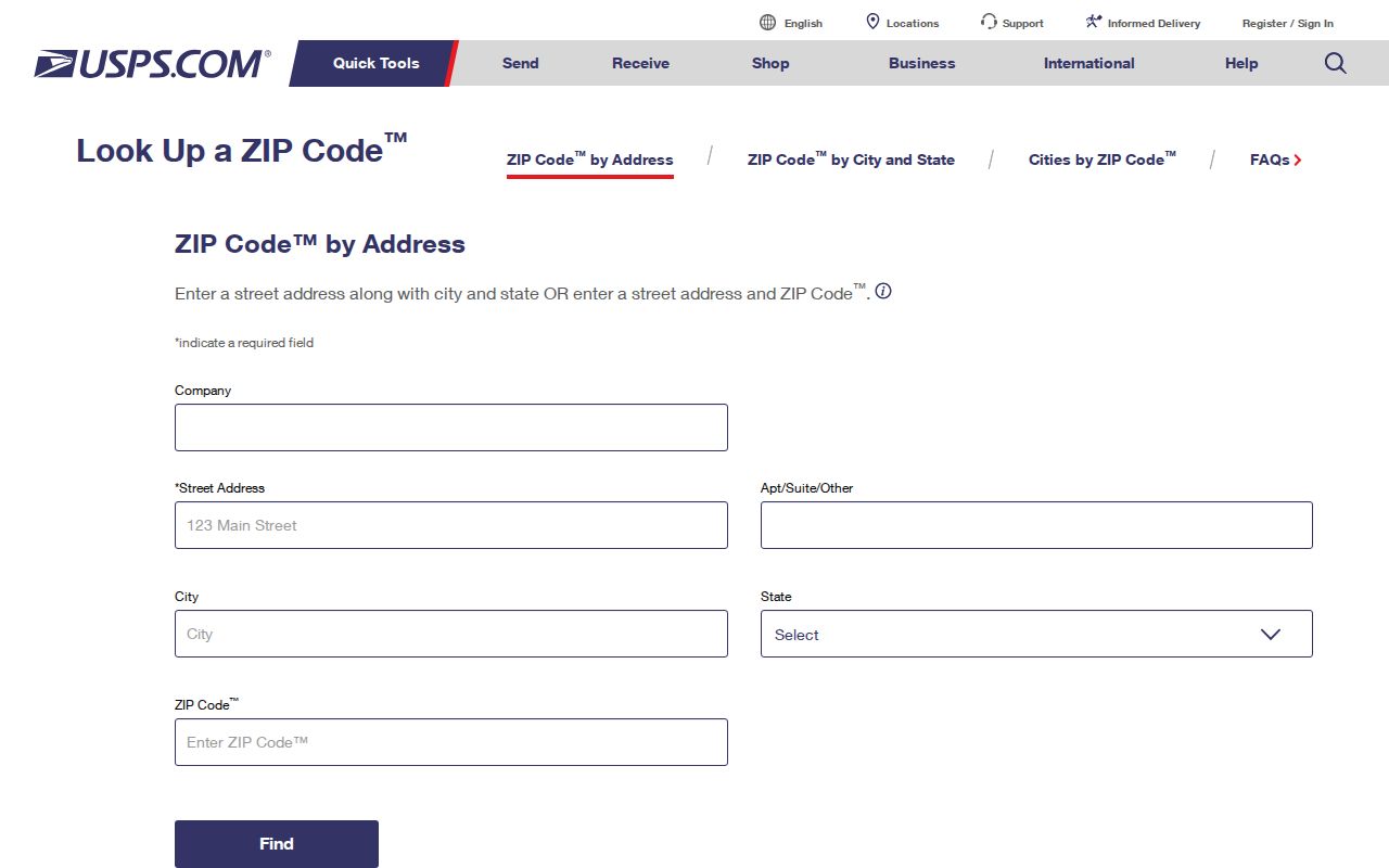
A returned USPS ZIP verifies a delivery designation. County maps and parcel fields still determine whether the same address belongs in Spring Valley’s county-administered record path.
Note: A ZIP result and a local-government label answer different questions about the same Spring Valley address.
Spring Valley ZIP Code Searches
A ZIP is not a broad owner or voter filter in every public system. The Clark County Assessor hub lists parcel number, owner, address, subdivision, book and page, parcel tree, and map routes, but not a ZIP field. Clark County voter files are organized by county or district and status, not a visible ZIP filter. Do not imply a ZIP-wide property or voter search where the reviewed interface does not provide one. Use the ZIP to verify an address, then use the address or APN in the parcel systems.
| Tool or record | Verified fields or route |
|---|---|
| USPS address tool | Street address, city, state, and ZIP workflow for delivery verification |
| Nevada Unclaimed Property | Last or business name, first name, city, ZIP, and property ID |
| Nevada Sex Offender Registry | Name, vehicle, geographic-radius-from-address, and Nevada ZIP modes |
| Clark County Assessor | Address or APN after ZIP verification; no verified ZIP field |
| Clark County voter data | County or district grouping and Active or All status; no verified ZIP field |
The Nevada Unclaimed Property search accepts ZIP as one field, but it is a claim clue rather than a list of Spring Valley residents. The Nevada registry has a ZIP search mode with statutory use limits and is also not a complete local directory. Those are the ZIP-capable functions documented in the research.
Clark County Development Review accepts an application number, address, or cross streets, while Building and Fire document search accepts application selection, record number, parcel number, location, and document type. Those address-based channels can help after a USPS check identifies the correct address. The reviewed sources did not show a ZIP-wide permit mode, so use the ZIP only as a verification field, then search the matched address or APN.
Spring Valley ZIP Boundaries
ZIP code boundaries are postal delivery areas. Spring Valley’s civic geography follows county administration, its TAB area, and CDP boundaries. A property can therefore use “Las Vegas, NV” as a mailing city while the Assessor calls its city or unincorporated town Spring Valley. The reverse issue also occurs at ZIP edges: an address in a ZIP associated with Spring Valley can fall outside the CDP or TAB layer. The map, parcel card, and USPS response must be read together.
Postal mismatch. Treat a Las Vegas mailing label as a delivery fact, then check the mapped parcel before assigning a Spring Valley jurisdiction.
Clark County’s Spring Valley map labels the town’s main road framework, including Sahara, Desert Inn, Flamingo, Tropicana, Russell, Warm Springs, Spring Mountain, Blue Diamond, Durango, Rainbow, Jones, and Decatur. Road names help a reader find the area on a map, but they do not substitute for an address-level boundary check.
Spring Valley ZIP Parcel Labels
Assessor and OpenWeb samples are especially useful for 89147 and 89148 because they show the local town label beside an urban postal designation. A parcel card can also show a subdivision, plat book and page, lot and block, recorded document, sale details, and building information. Those fields give an address search a stable record key. An 11-digit APN is more durable than a ZIP, which is why it should stay with every Spring Valley ZIP code note.
Newer southwest subdivisions are visible in the 1990s through 2020s parcel record examples. Older sources may use Las Vegas, a rural route, a tract name, or no current-style address. When a historical search fails, try the legal subdivision, historic street index, adjacent plat, or a newspaper instead of assuming the address had no earlier record.
Spring Valley ZIP Field Meanings
Record systems use several address terms, and mixing them causes false matches. The physical address on an Assessor, GIS, or permit record is the situs address. The tax mailing address can belong to an owner, trustee, family contact, or agent elsewhere. A legal description and APN identify the parcel and connect to Recorder or plat work. ZIP is postal geography. Court filings may show service or mailing information, while voter data reflects registered residence when that field is not protected.
- ZIP versus ZIP+4
- A ZIP identifies a broad delivery area. ZIP+4 adds a delivery segment and does not establish a neighborhood boundary.
- PO-box ZIP
- A ZIP used for post-office boxes rather than ordinary street delivery.
- Unique ZIP
- A ZIP assigned to a single large organization or destination, not a general town line.
- Carrier route
- A postal delivery grouping within an area; it is not a county jurisdiction or a resident roster.
Spring Valley ZIP Code Totals
Clark County’s 2024 ZIP population report is useful for showing the scale of postal areas, not the population of Spring Valley itself. For example, the county table gives totals of 45,463 for 89103, 44,370 for 89113, 55,809 for 89117, and 28,009 for 89118. Each total includes residential categories across a ZIP area that may overlap several communities. Do not describe those figures as Spring Valley population counts without a boundary overlay.
That distinction matters when comparing ZIPs in the Spring Valley ZIP code directory. A large total may reflect the size of the postal area, not the number of people inside the town or at a particular address.
Note: County ZIP totals are postal-area aggregates and should not be converted into Spring Valley totals without mapped boundaries.
Spring Valley ZIP Street Search
Once a ZIP check identifies the right part of the valley, switch to an exact address and parcel rather than attempting to create a ZIP-wide list. The Assessor address search and OpenWeb map then provide an APN, situs, legal description, and mapped context. A street-level record chain may continue through Recorder documents, permits, and historical address tools, each with a different purpose.
For that address-by-address workflow, use the Spring Valley street directory. It handles the parcel and street chain without treating a postal ZIP as proof of who is at every address.
Spring Valley ZIP Code Limits
A ZIP reference is geographic, not a people list. An Assessor record can establish a property connection, but ownership is not occupancy. A voter record may be protected or withheld. A court record can contain a mailing or service address that is neither current nor residential. Use documented portals for the narrow question each one can answer, and preserve the source date before relying on a result.
For a request that cannot be answered online, describe an existing record by address, APN, date range, or application number. Nevada public-record rules do not require an agency to create a ZIP-wide file that it does not already maintain. A precise request also makes it easier for the correct county office to identify confidential material that must be withheld or redacted.
Commercial neighbor and people tools often combine old address associations with public data. Their categories and timing may be unclear. Official USPS, county GIS, and custodian records make it easier to identify what an address field means and what it does not prove.